

King Charles III England Coast Path: Visitor Maps
Natural England is a government body advising on and protecting the natural environment. The England Coast Path is one of the largest coastal walking routes in the world, creating continuous public access around the coastline of England. As part of an ongoing collaboration between The Way Design and Natural England, a series of visitor maps and interpretation panels were developed to help walkers explore the route and discover the wildlife and landscapes along the way.
Working as a freelance designer within the team at The Way Design, I helped develop the visual style of the maps and contributed to the icon set used across the project. I created visitor maps, illustrated species including birds and dogs, and designed large-format interpretation panels that aligned with the established brand.
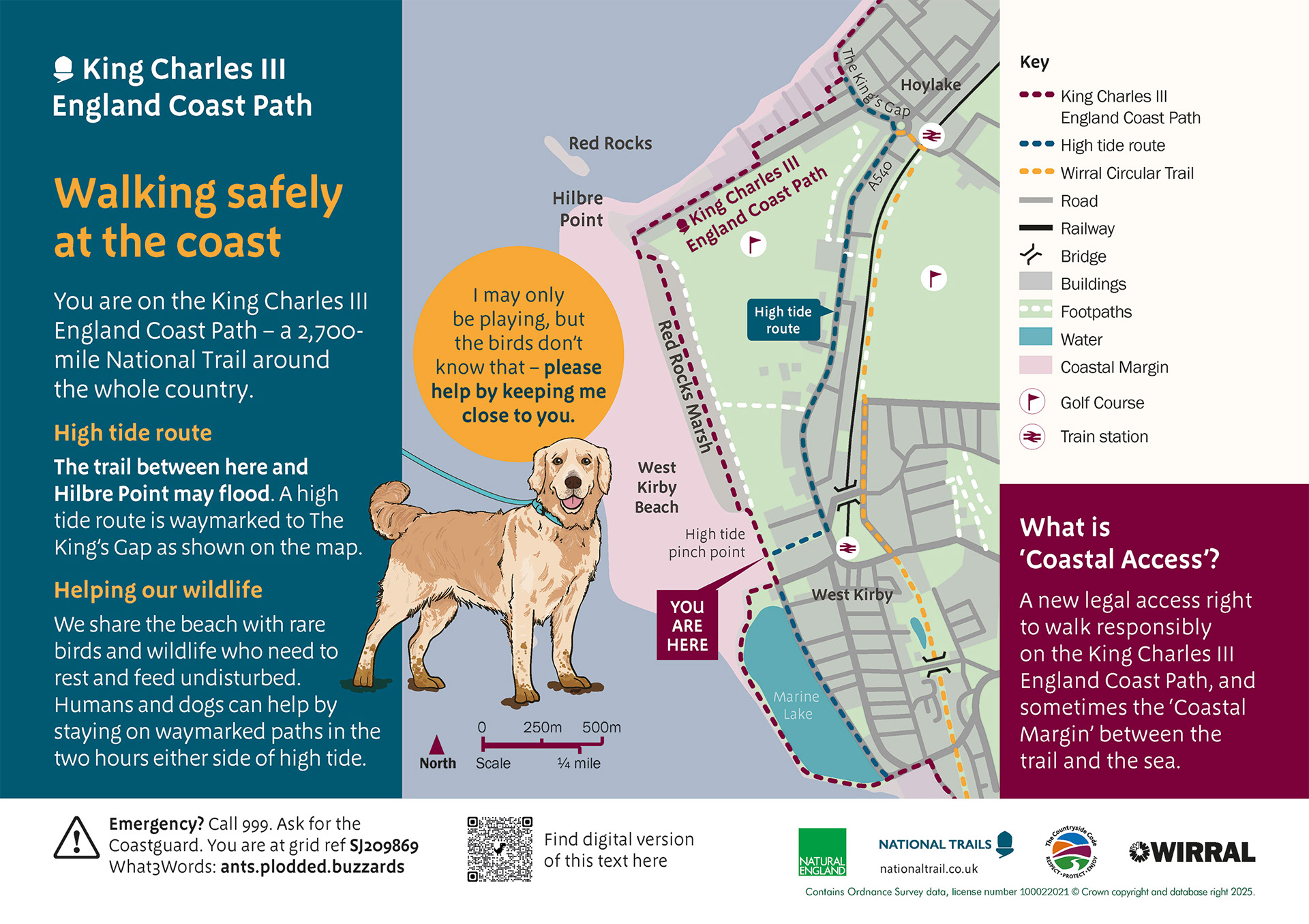
West Kirby North Panel: Size A3
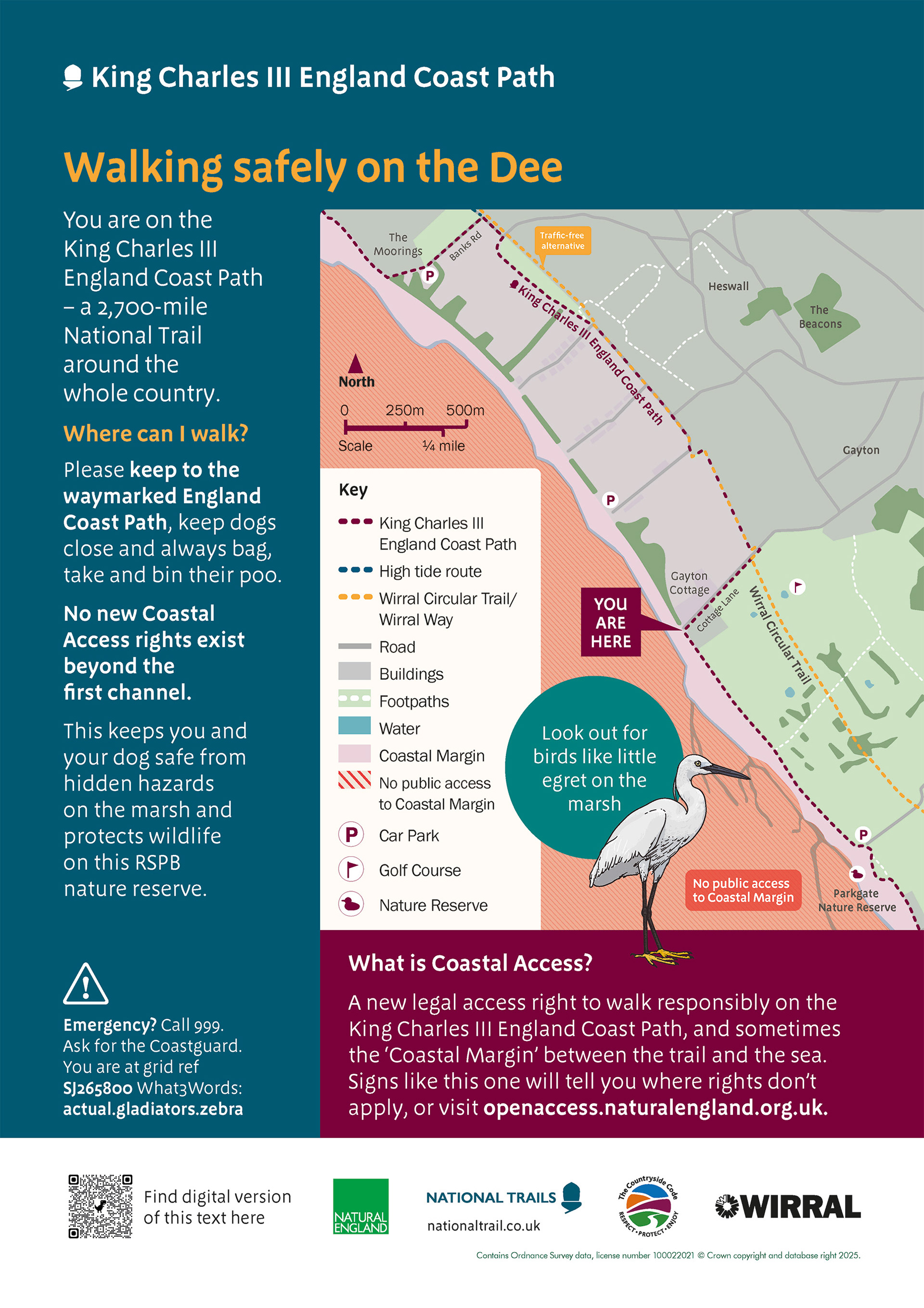
Gayton Cottage Panel. Size A3
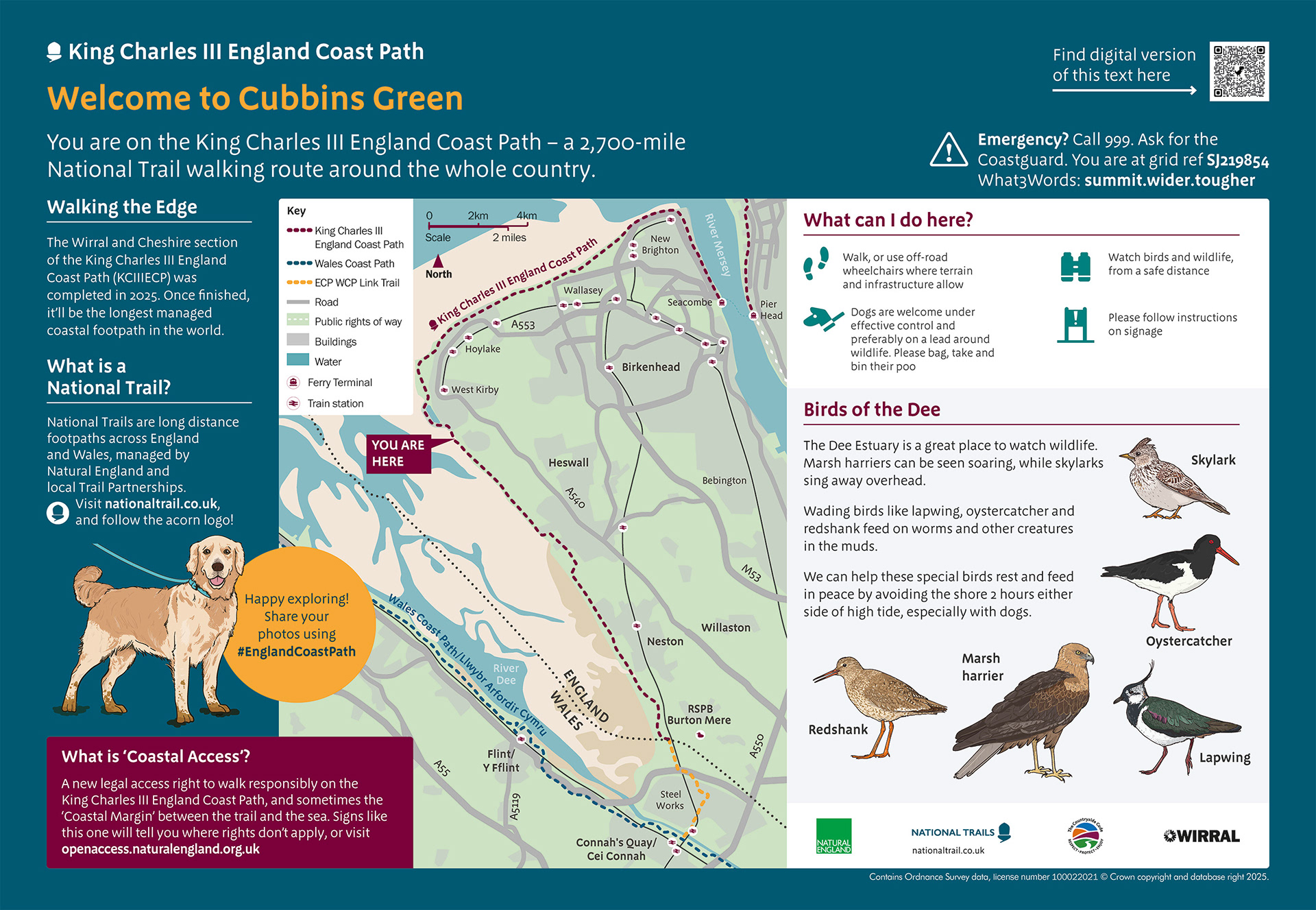
Cubbins Green Panel. Size A1

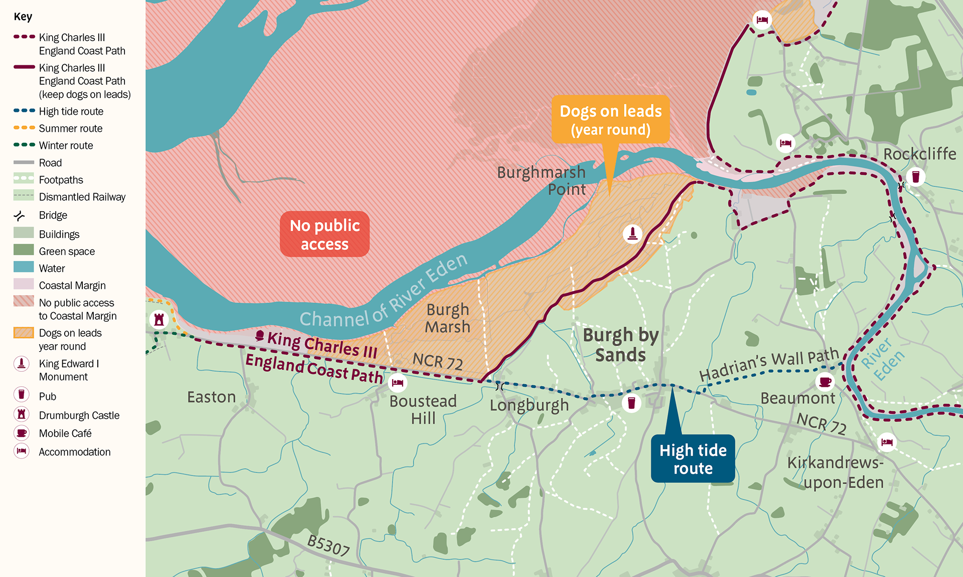
England Coast Path Map
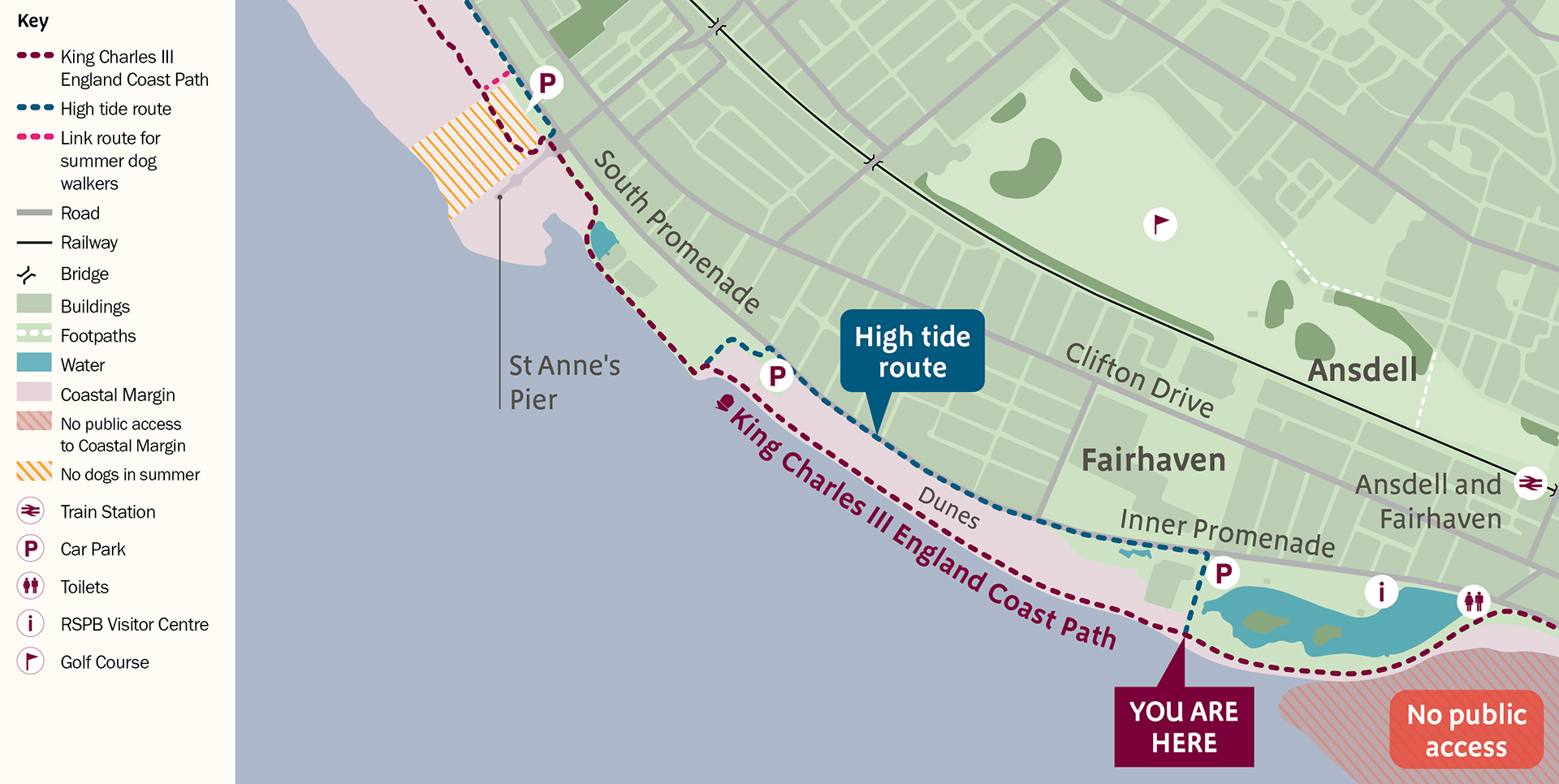
England Coast Path Map
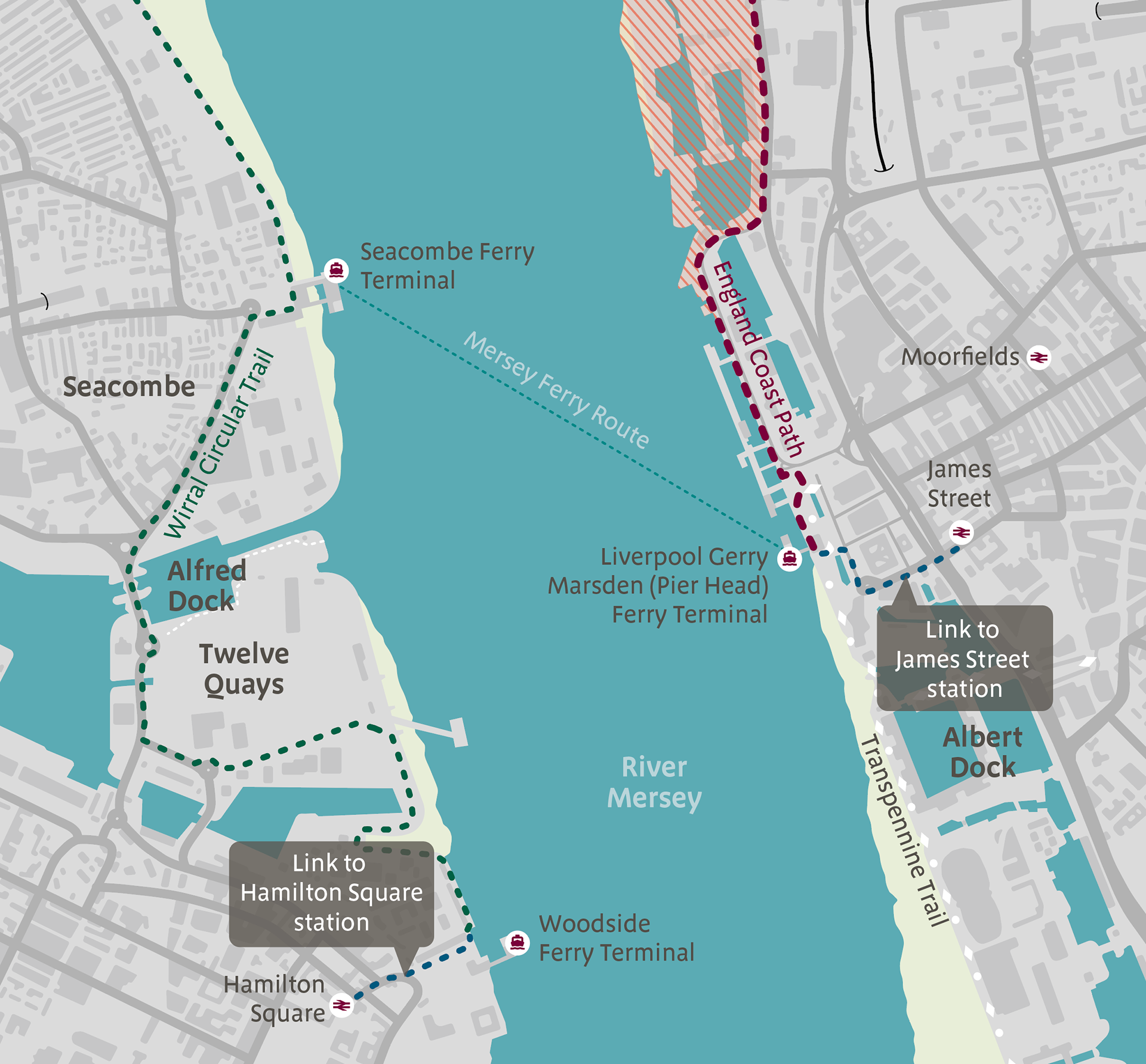
England Coast Path Map: Liverpool
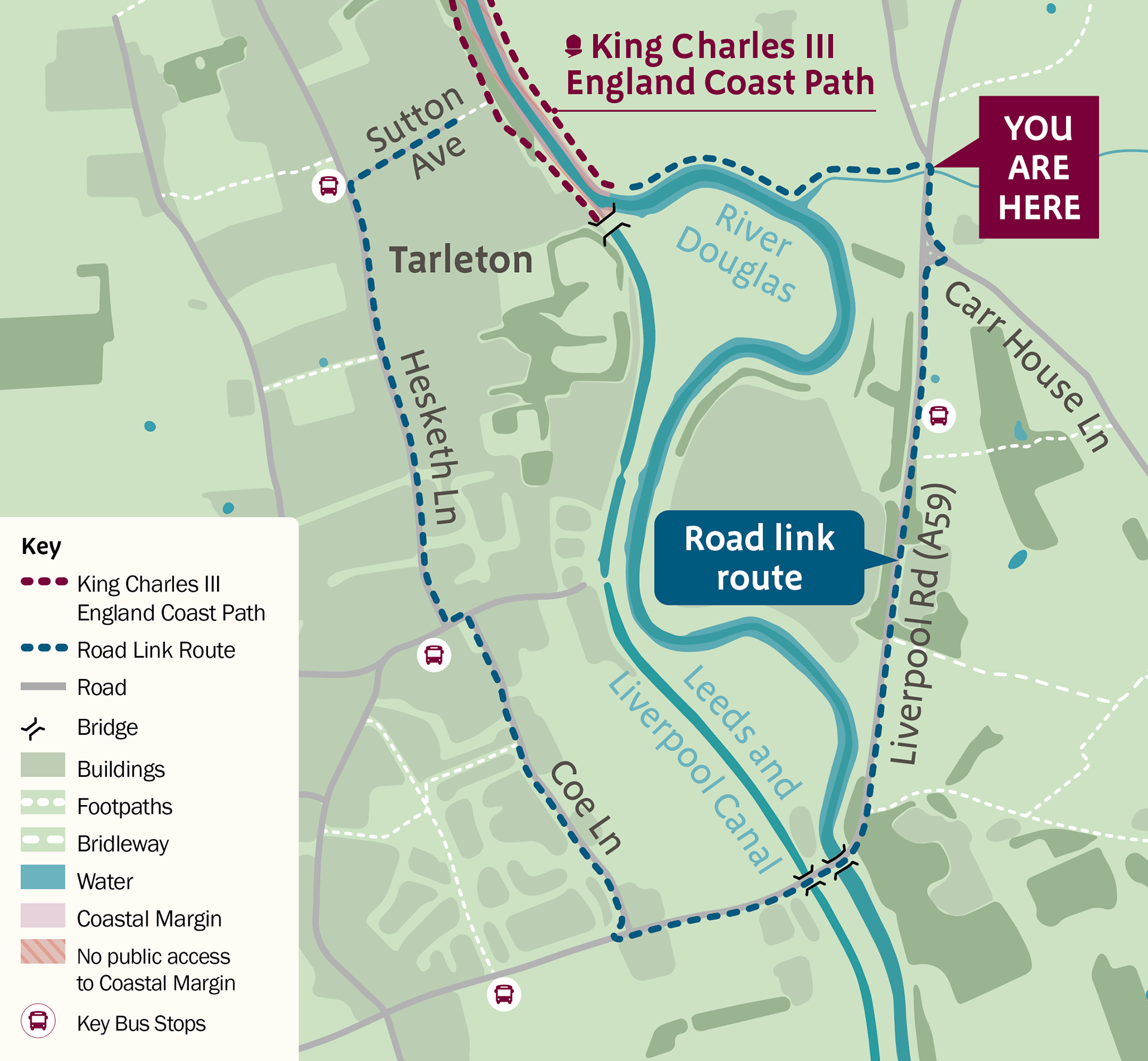
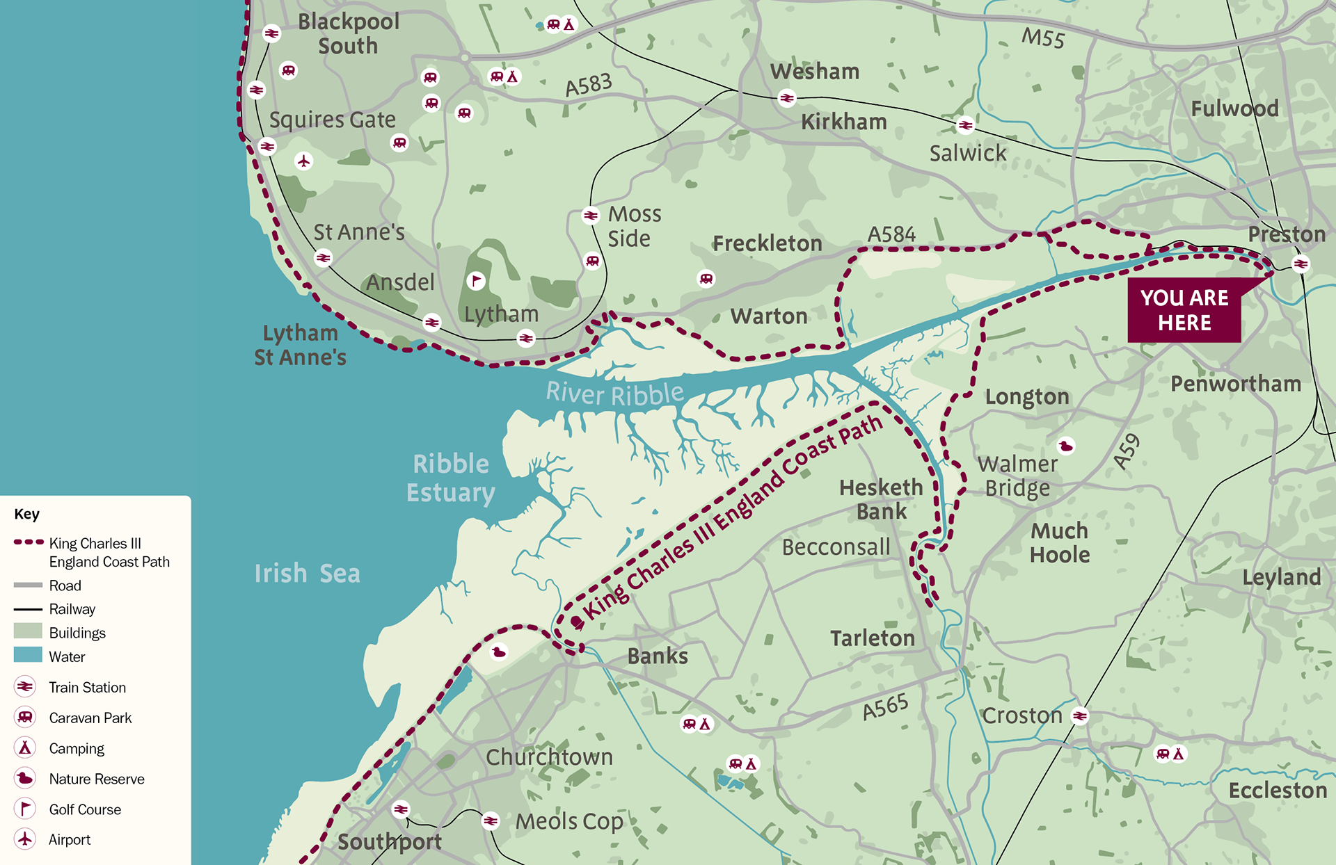
England Coast Path Map
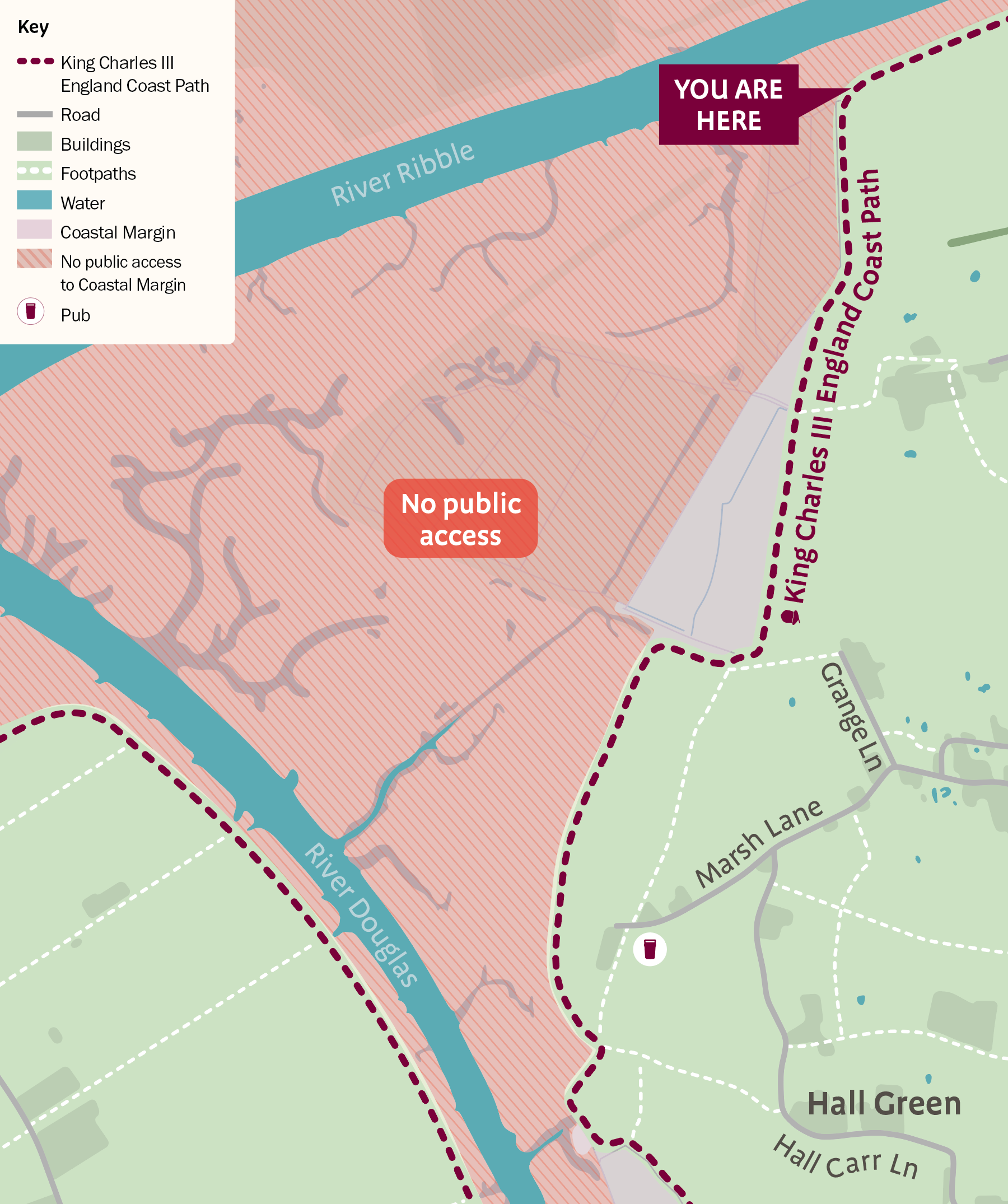
England Coast Path Map

Selection of icons used as part of a wider set
Species illustration
A wide rage of detailed species illustrations were used across the England Coast Path wayfinding and information panels
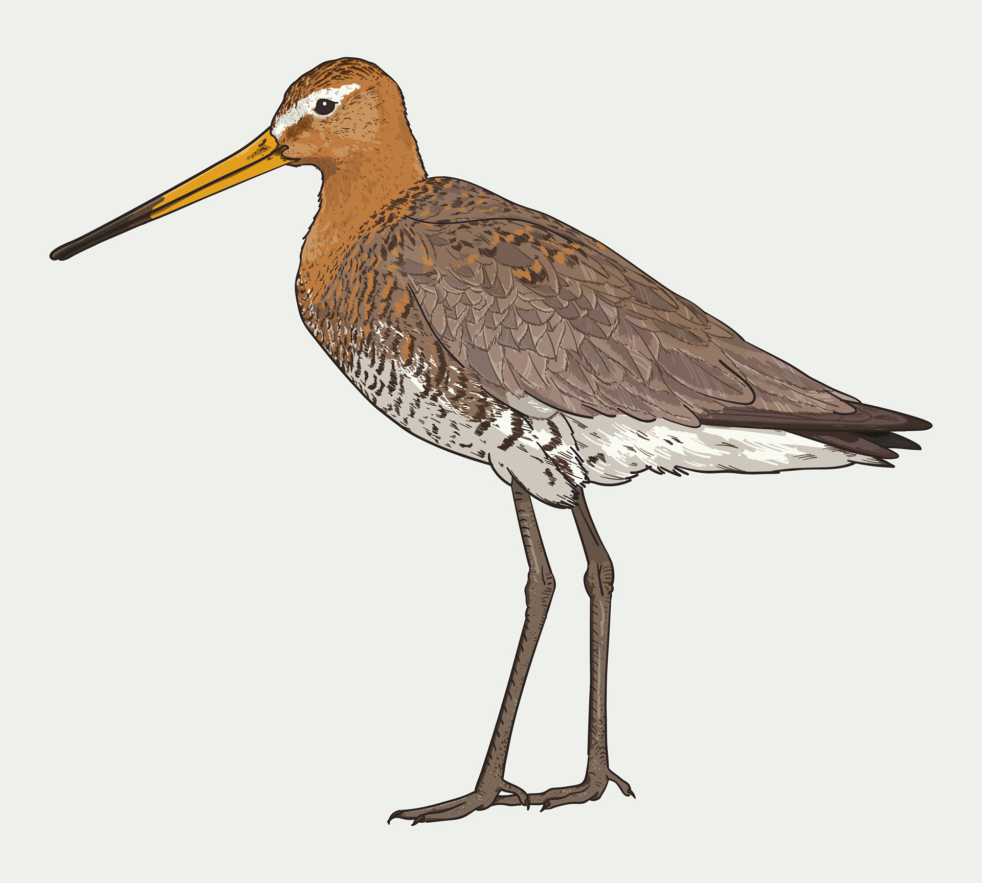
Back tailed godwit illustration
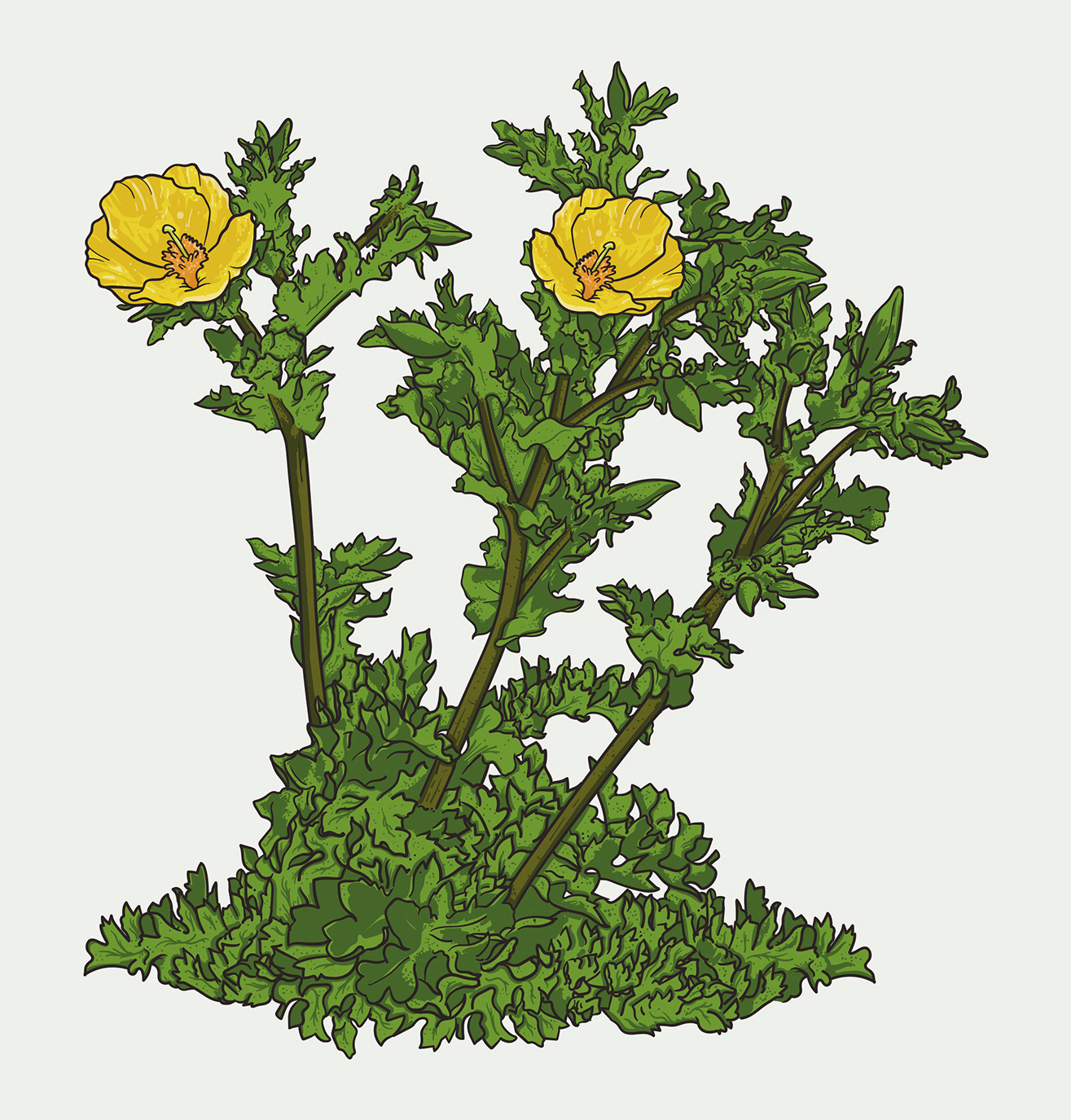
Yellow horned poppy illustration
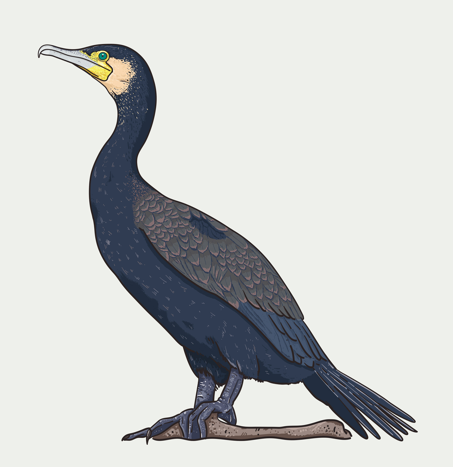
Cormorant illustration
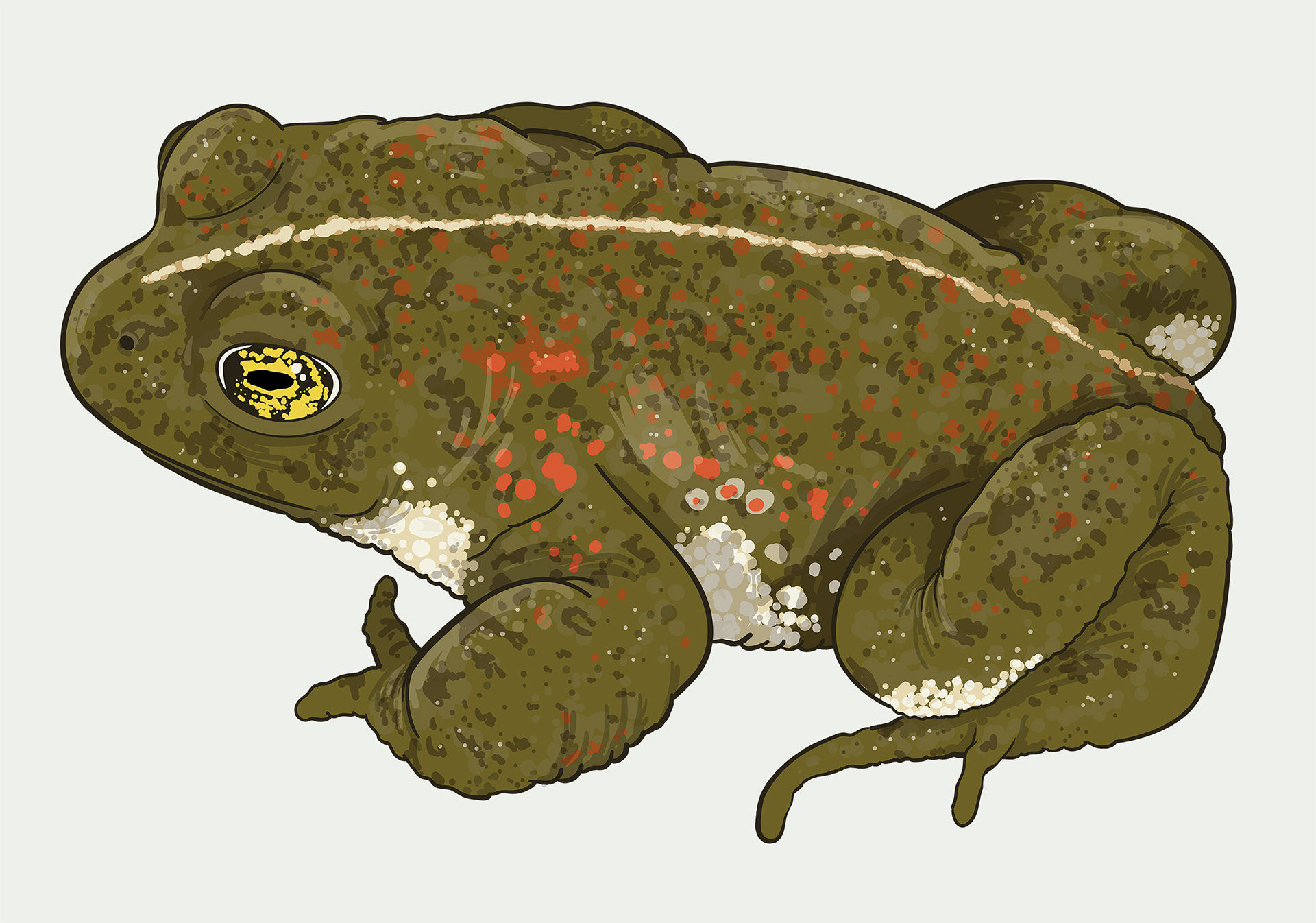
Natterjack Toad illustration
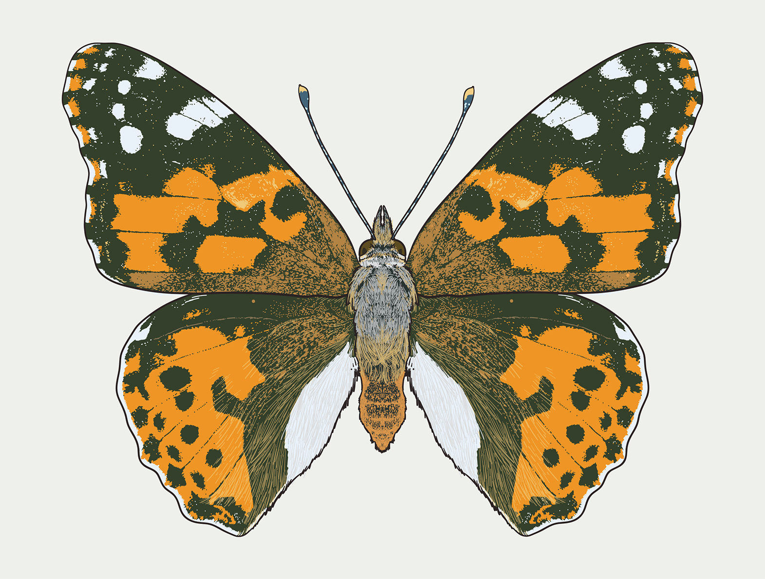
Painted lady butterfly illustration
Credits
These 100% vector maps and illustrations were created by Ben Horne – Ben Makes Maps with Adobe Illustrator and without the help of AI.
Map data from Ordnance Survey.
Licence number 10002202
Map data from Ordnance Survey.
Licence number 10002202

Need a custom map for your project?
