

Nature Calling: View In View Out Visitor Maps
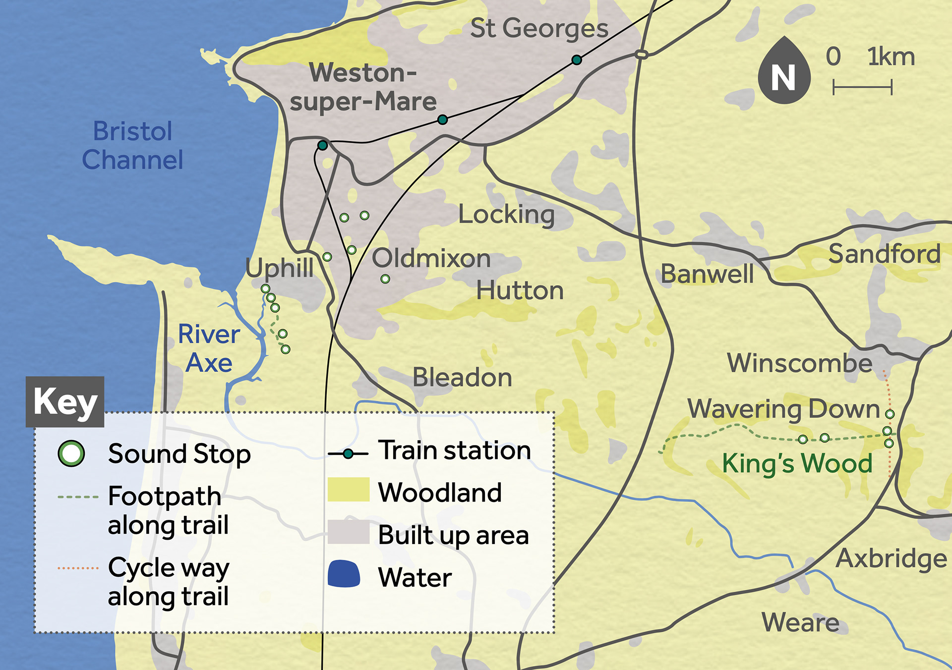
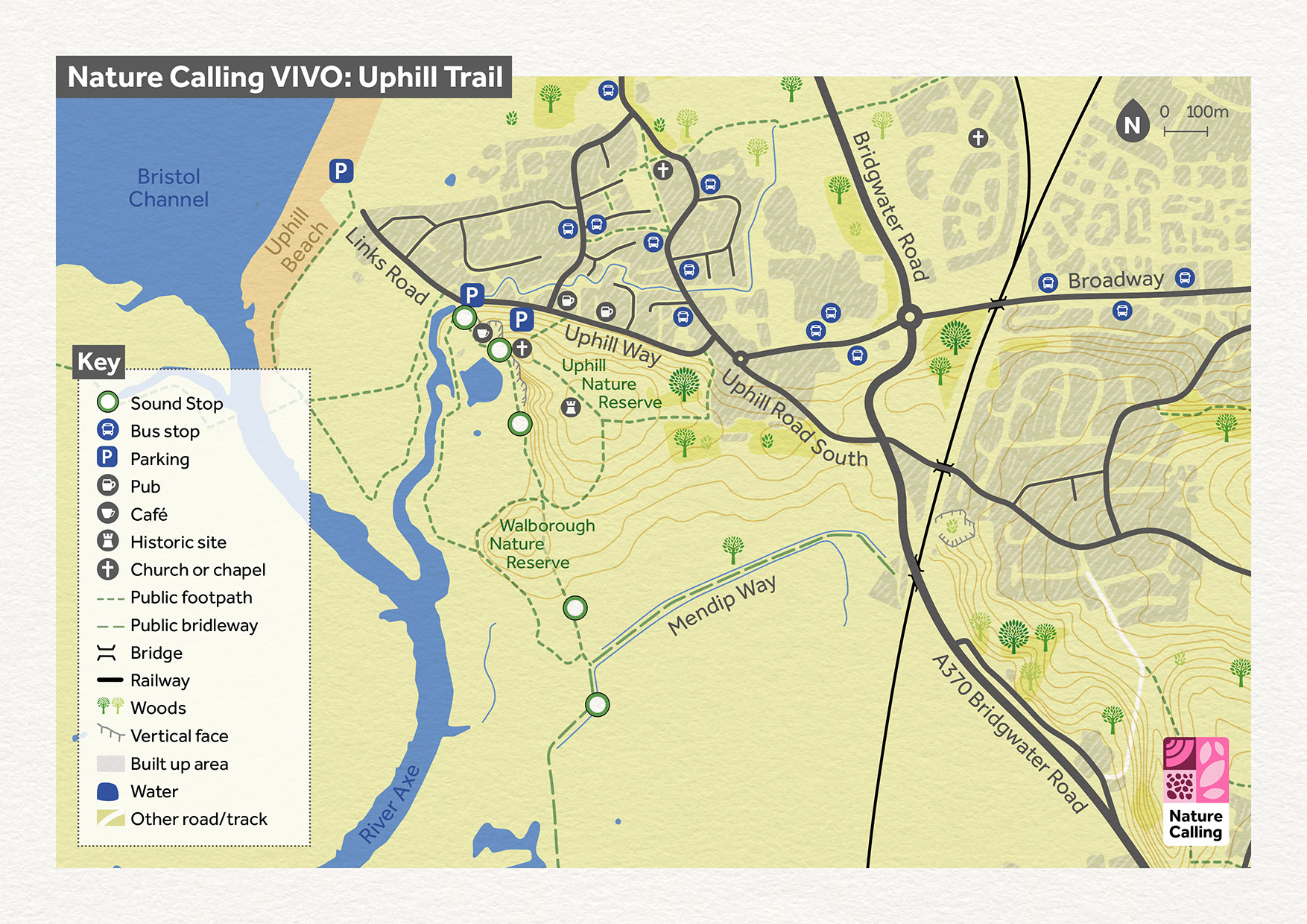
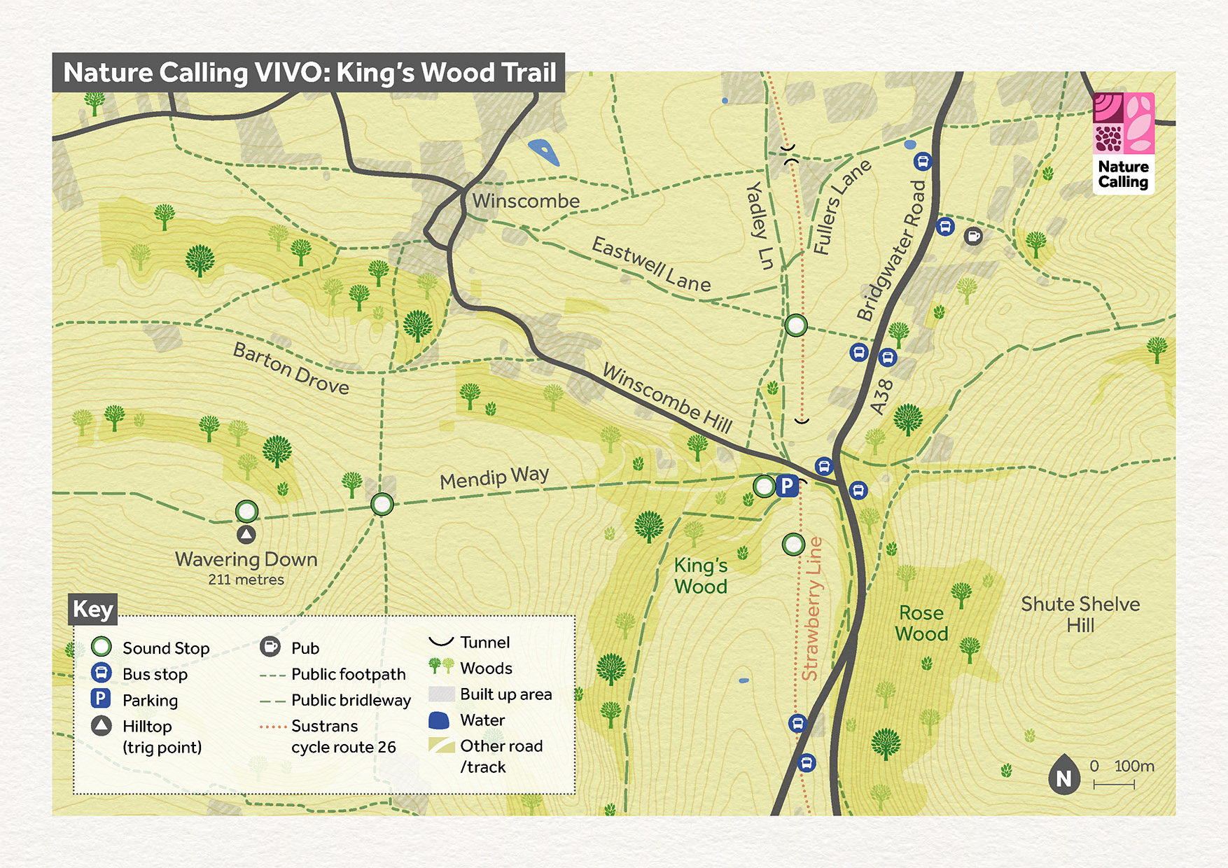
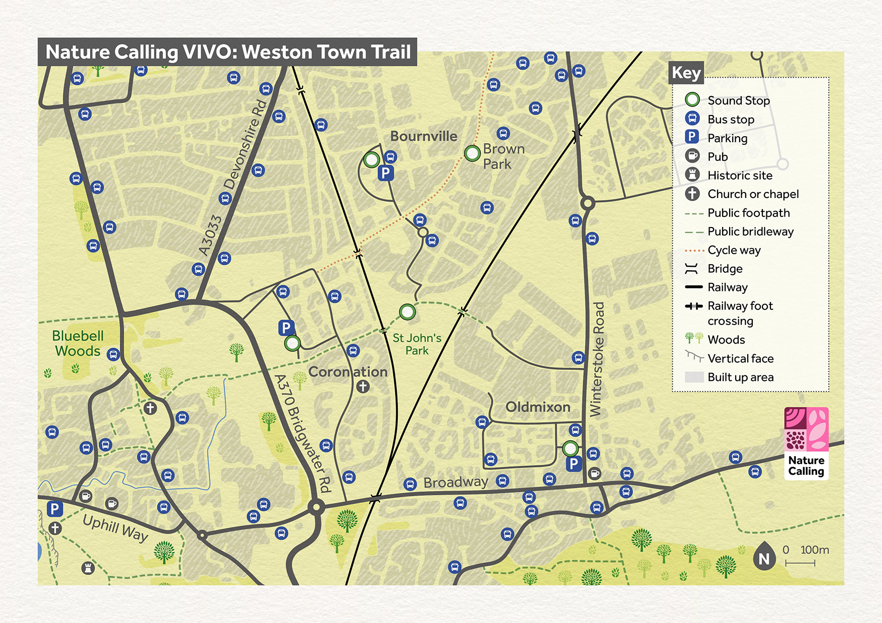
Commissioned by The Way Design for the National Landscapes Association, this project formed part of an augmented reality nature trail across Weston, Uphill, and the Mendip Hills near Winscombe. Visitors were invited to explore a series of walking routes where illustrated maps, sound, and animated wildlife came together in a place-based experience.
I designed an overview map and three trail maps, each leading to five “Sound Stops” where users could listen to poems, interviews, and field recordings, while seeing illustrated animals brought to life through a mobile AR app.
Credits
These 100% vector maps were created by Ben Horne – Ben Makes Maps with Adobe Illustrator and without the help of AI.

Need a custom map for your project?
